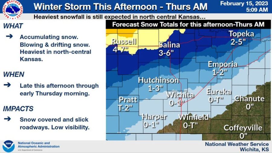
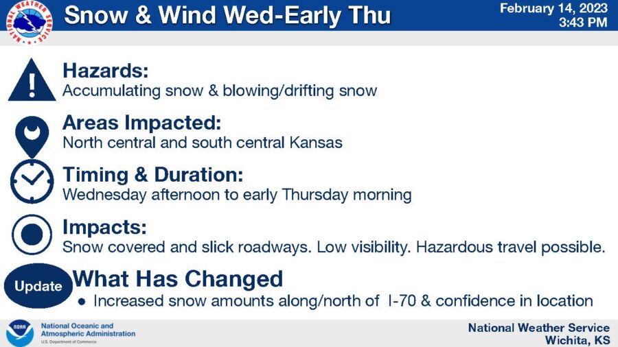
(NWS) – A storm system will bring accumulating snow to the region Tuesday afternoon through early Thursday morning. Gusty north winds will cause blowing and drifting of snow along with reduced visibilities mainly over central Kansas. Impacts to travel are expected across north central Kansas.
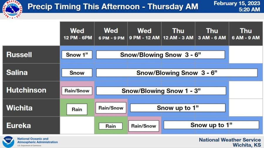
Here is the timing for precipitation across the area late this afternoon through Thursday morning.
A Winter Weather Advisory has been issued from 3 p.m. Wednesday to 9 a.m. Thursday. Plan on slippery road conditions, patchy blowing snow and reduced visibility. Hazardous conditions could impact your morning or evening commute. Expect near-zero wind chills Thursday morning.
Tuesday
A chance of rain and snow after 3pm. Cloudy, with a high near 38. Breezy, with a northeast wind 17 to 22 mph, with gusts as high as 26 mph. Chance of precipitation is 50%. Little or no snow accumulation expected.
Tuesday Night
A chance of rain and snow before 8pm, then snow. Patchy blowing snow after 10pm. Low around 16. Wind chill values as low as zero. Blustery, with a north northwest wind 18 to 25 mph, with gusts as high as 38 mph. Chance of precipitation is 90%. New snow accumulation of 1 to 2 inches possible.
Thursday
Patchy blowing snow before noon. Cloudy through mid morning, then gradual clearing, with a high near 32. Wind chill values as low as -1. Breezy, with a north northwest wind 15 to 24 mph, with gusts as high as 34 mph.
Thursday Night
Clear, with a low around 15. North northwest wind 6 to 10 mph becoming west southwest after midnight.
Friday
Sunny, with a high near 47. Southwest wind 6 to 14 mph, with gusts as high as 20 mph.
Friday Night
Mostly clear, with a low around 29. Breezy.
Saturday
Mostly sunny, with a high near 54. Breezy.


